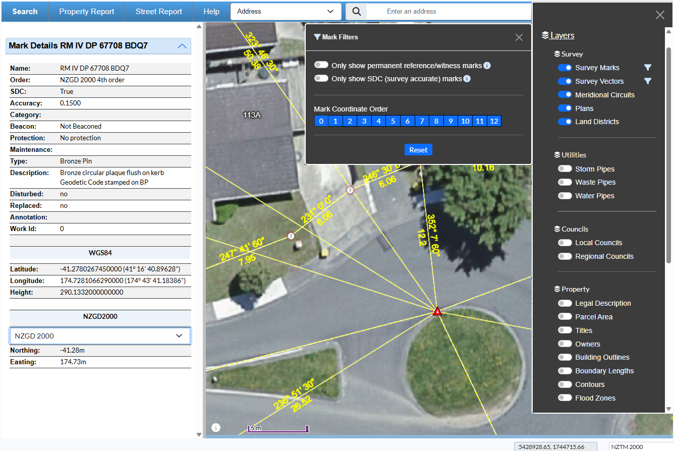
Prover integrates Quickmap’s Surveyview Mark and Vector data, providing direct access to authoritative cadastral survey information.
📍 Nationwide Survey Observation & Mark Data
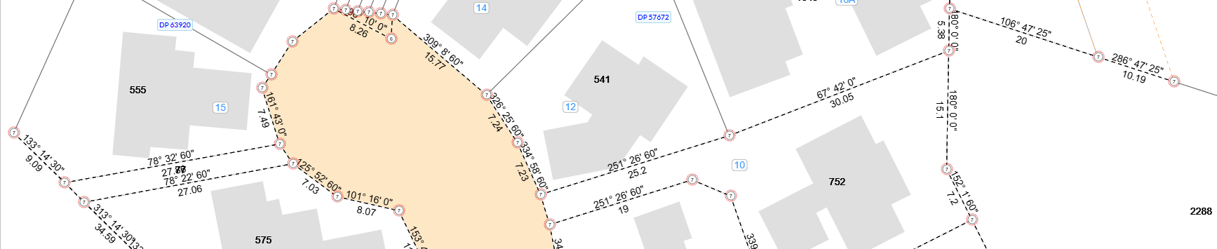
Sourced from Landonline, New Zealand’s official survey and titles system maintained by Toitū Te Whenua – Land Information New Zealand (LINZ), this integration exposes approximately 60 million survey observations nationwide, offering the most comprehensive digital representation of cadastral survey evidence available outside the Landonline environment.
The dataset is updated weekly and provides coverage for every cadastral parcel in New Zealand, enabling surveyors and land professionals to assess boundary definition, positional accuracy, and survey reliability directly from the map.
Attributes of map features such as marks and observations can be viewed by simply clicking the feature. Survey marks are typically displayed as circles with the coordinate order shown in the centre.
If a mark includes a red circle, LINZ has identified it as part of the Survey-accurate Digital Cadastre (SDC)
Being able to easily identify SDC-approved marks on the map helps users make more informed decisions when interpreting boundary position, assessing survey quality, and managing spatial risk in property, infrastructure, and land development contexts.