
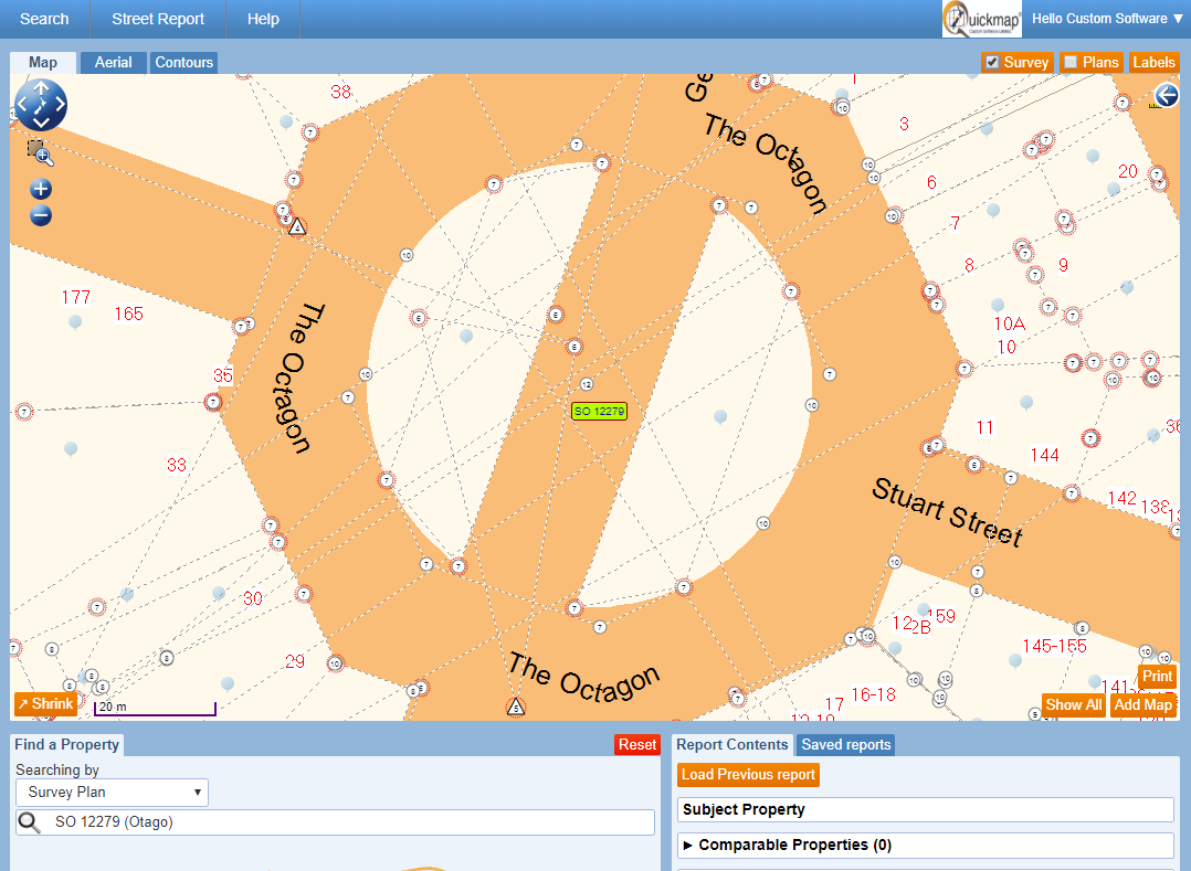
Survey Plans FREE for download
With the largest private collection of survey plans in New Zealand, Prover provides free access to 98% of Survey Plans in the pre-300,000 series, as well as many in the post-300,000 series. We update our database daily, adding an average of 170 new plans per day in 2020 alone.
Location services
Access survey data when out in the field and show your location on the map using your GPS enabled phone or tablet.
Survey mark and vector data
Prover includes Quickmap’s Surveyview Mark and Vector information. This provides you fast access to details on around 60 million observations and 11 million marks throughout New Zealand – an essential data set for surveyors who need to know how accurate the boundaries are on the map.
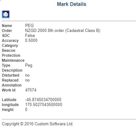
The data is updated monthly, and provides survey
information for every parcel in New Zealand.
Mark information includes:
- Mark Source
- Coordinate System
- Authorative Coordinates
- SDC Status
- Mark Status
- Mark Type
- Mark Name
Perhaps the most important information associated with the mark is its Survey Accurate Digital Cadastre Status (SDC). Surveyview provides an SDC layer which will circle the mark in red if it has achieved SDC status. Where the survey data meets the accuracy, standards required in the Survey Regulations, the marks are assigned SDC status by Land Information New Zealand (LINZ).
FREE Title preview
This allows you to preview the information within a Certificate of Title without having to order it. This can be used to get information, fact check, or confirm that you are ordering the correct title before you order it using Prover’s easy one-click title ordering system – which is the cheapest and fastest title ordering in New Zealand.
High quality NZ aerial photography
Prover also offers high resolution aerial photos and a standard map view that you can use to search and view information on, such as:
- Easements that aren’t listed on the Certificate of Title
- Parcel data (Legal Boundaries, Statutes, Titles and Valuation References on a parcel, etc.)
- Sales data
- Ownership data